


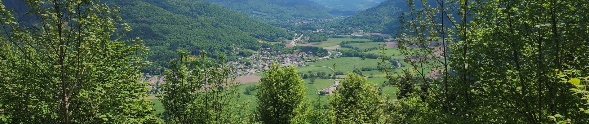
la rosière, circuit des milles étangs

francislassauce
User
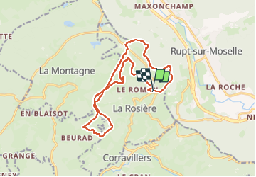

Length
15.6 km

Max alt
817 m

Uphill gradient
418 m
Km-Effort
21 km

Min alt
656 m

Downhill gradient
400 m
Boucle
Yes
Creation date :
2025-05-11 07:51:56.516
Updated on :
2025-05-11 11:58:58.622
4h06
Difficulty : Very difficult

FREE GPS app for hiking
 SityTrail
IGN / Geographical institutes
SityTrail Plus
The world is yours!
About
Trail Walking of 15.6 km to be discovered at Bourgogne-Franche-Comté, Haute-Saône, La Rosière. This trail is proposed by francislassauce.
Photos


Positioning
Country:
France
Region :
Bourgogne-Franche-Comté
Department/Province :
Haute-Saône
Municipality :
La Rosière
Location:
Unknown
Start:(Dec)
Start:(UTM)
323176 ; 5309416 (32T) N.
Comments